June 07, 2010 – Tornado!
- Route map
- Photo gallery
- Trip meter: About 470 miles
- Time: 10 hours
- From: Ogallala, NE to Ogallala, NE
- Summary: Tornado virginity taken by a rain-wrapped cone approaching at 40 MPH from 1/2 mile away
Finally.
We took our time again this morning. Hannah, Justin, and I got to sit in with Roger for about an hour to pick his brain as he explained his daily routine for checking the weather models and making target forecast fot the day. Then we did a little Weather 101 lesson on the Days Inn lobby with the whole tour as he went over the basics of supercells and severe weather forecasting.
Then he went over the day’s forecast. Outflow from an overnight MCS was set to meet up with a warm front approaching east of a surface low in NE CO. The warm front was to bring high temps in the 90s and provide the lift necessary to break the nuclear cap. We left for Fort Morgan at about noon.
We stopped at Fort Morgan and watched in awe as dewpoints were rising rapidly. 82 over 66 was a typical temperature-dewpoint spread in eastern CO, which is a phenominal environment for supercells. We decided to go further north for lunch in Kimball. VORTEX2 was there as well and we were picking them up on the radio.
Well, storms started firing way north where the cap was quickly weakening and instability was more than sufficient. We went north of town and sat for a while, considering our options. North was looking too good. V2 had the same idea. The whole armada cruised by going north towards Scottsbluff, and we followed suit.
We meandered through Scottsbluff and the national monument (beautiful) and went north towards our first cell of the day. Storm motion was pretty brisk, about 35-40 MPH. We sat for a while in Torrington and watched it develop.
However, our cell was gusting out and quickly dying. You could see that the outflow was kicking up dirt along the ground and cutting off the inflow. We drove back east in front of the storm. It looked like our day was done.
But there was One More Thing.
This little cell that had popped up along the outflow of our storm suddenly showed great structure and was intensifying quickly on radar. Meanwhile our storm was choking itself off and petering out.
We sat directly south in sight of both cells near Torrington, with Roger trying to make up his mind. “Let’s stop here for a second. I just want to see one more radar scan.” That was all he needed to see, and we quickly got on the western storm. Surprise: V2 did, too. The storm had taken a hard right turn and was diving southeast right along our road, Route 26.
We booked it back west and tried to find a north road option. With the heay rain now wrapping around the mesocyclone, the storm was taking on a high-precipitation (HP) characteristic, and the only way to see a tornado would be directly to the east of the cell, in the “notch”. We went back to Scottsbluff and took Route 71 north to get a good look.
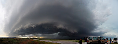
This storm was a beast, without a doubt. It was churning through the air and blasting everything in its path with severe wind and gigantic hail.
With that special tone in his voice, Roger informed us it was time to leave. Now. The thing raced us back south as we skirted around Scottsbluff. The core of this thing was green as a gemstone.
Wait, what? Tornado warning? On the ground? Indicated by a trained spotter? There was no way anybody could see a tornado back in that mess. Roger was skeptical. We stopped east of town on Route 26 alongside a V2 DOW and got out. “Stay near the vans! Don’t go wandering off!”
We squinted into the churning gullet of this cell, which was completely obscured by precipitation. Then Justin though he saw a power flash. Then I saw a bright green power flash. Then Karen yells, “tornado!” aaaaand it’s time to go.
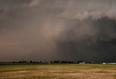
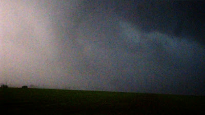
Buried deep in that downpour less than a mile away was a large cone tornado headed directly for us. We couldn’t see it until it was nearly on top of us. I didn’t have time to take pictures, but the video captures it all. We trucked along Route 26 west of Scottsbluff as the tornado was about the cross the road perpendicular to us. The RFD really picked up and rain pelted the van as trees and grass bent over under the wind. At this point the tornado was nearly on top of us. It was probably only a half mile away and yet we could barely make out the outline of the funnel.
Roger screamed on the radio as we then busted west and the tornado was bearing down directly behind us. “We’ve got to move! Quickly! Really quickly! There’s a cone tornado in there, I can see it!” We did our best jockeying around other cars caught in the mess, trying to keep the SLT convoy together.
—he
After a few more miles we were clear of danger. We stopped a few more times and let the storm catch up to us as we took some more pictures. Lightning activity picked up as the cell finally gusted out and merged into a giant linear system that raced us all the way back to Ogallala. Ogallala, of all places.
I don’t even know how to feel right now. Exhaustion. Accomplishment. Exhiliration. It’s all flooding over me. I think it may take a day or two to fully sink in. Until then, enjoy the pics, and I will try to get some video up soon as I can.
9:30 tomorrow! Let’s do it! Again!


