June 20, 2006 – Day 3 Summary - Success!
Summary
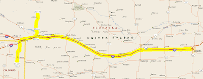
- Route map
- Photo Gallery
- Trip meter: Far
- From: Grand Island, NE to Ogallala, NE (actual name)
- Summary: Witnessed two long-lived supercells, one LP and one classic; saw a killer lightning show
Excessively Long Summary
Words alone can’t describe how unbelievable today was. Months of reading, learning and discussing all came together in this chase. Today was all about making the right decisions. We travelled 90 miles east of Grand Island just so we could sit at another Wal-Mart and make a decision of whether to go east into Iowa or back west to Colorado. Iowa had insane sheer but also an insane cap, whereas northeast Colorado had upslope flow and good moisture going for it, but nonexistant directional sheer.
Roger decided that the COlorado setup looked better, so we retraced our steps from that morning. By the time we were around North Platte, storms were already firing off the Cheyene Ridge and were intensifying as they moved westward. The first few cells went up in a cluster, but one storm quickly dominated. It did a hard right-split, as expected, but unexpectedly the right storm quickly shrivelled up and the left storm took precedence. We followed this cluster of storms north from the I-80/I-76 split.
Way off to the south, we could see rock-hard updraft towers of storms in northeast Colorado, 100 miles away. Roger then made the hardest decision of the day to retrace our steps back south to catch up with those storms. It turned out to be the right decision.
We sped south and approached the biggest storm from the north, which soon became tornado-warned from a “trained spotter sighting,” but this was likely a false alarm. Either way, the storm was intensely rotating on radar, with over 160 knot gate-to-gate shear. We drove through the leading edge of its precipitation core and observed two massive inflow bands streaming into the storm. We stopped south of the storm to see its structure. It was a textbook LP storm, with a very high base and a corkscrewing updraft tower, with striations all along the base. It was truly amazing.
Over an hour or so, the storm slowly propigated directly over our heads, creating lowering after lowering, just trying to spin something up. A huge RFD cut form and occluded part of the meso, and there may have been a tiny funnel back in there, but the occlusion disconnected from the storm and promptly died. After that the storm basically quit, but it tried for the longest time to stay alive and fooled us a few times even as it was gusting out.
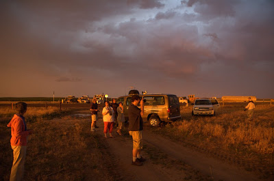
We moved slightly further south to watch another, much larger, supercell approach us. This one had classic structure with a nice round base that was relatively low to the ground, and it had strong, strong rotation. Scud was being sucked up into the base, and a wall cloud formed, but the storm gradually gusted out.
As if those displays of nature’s power weren’t enough, soon the sun sank behind the supercell and lit up the whole underside of the storm, with lightning to complement it. What a show. The pictures tell the whole story.
Well, the pictures tell most of the story. To know what it feels like to stand in the path of a storm twenty miles across and twelve miles high, you really have to just go do it. Read all the textbooks, watch Twister a dozen times, or look at the pictures over and over; they are all static. Nothing can truly express the dynamic nature of these beasts, short of being there to witness – no, experience – it.
What a trip.
Quotes of the Day
Roger: (as we turn around) “I can’t do it. I can’t chase this thing. It’s crap.”
Steve: “You’ve got to watch out, Roger; you wouldn’t want any hail to dent the van.”
Final Thoughts
- Everyone agrees that today was absolutely worth the two days of frustration. You would, too.
- Iowa didn’t see crap today! Phhhbbbbtttttt :-P (and I even wore my Iowa shirt!)
- I’m beginning to see the advantages of chasing outside of a chase tour, namely not having to climb out of the back of the van whenever we stop.
Audio
- 9:40 AM –
- 12:42 PM –
- 3:52 PM –
- 6:33 PM –
- 7:26 PM –
- 8:03 PM –
- 10:38 PM –
Photos
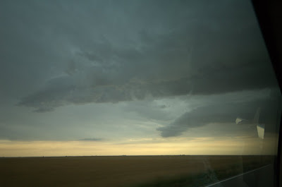
Check out those two inflow bands! Craziness.
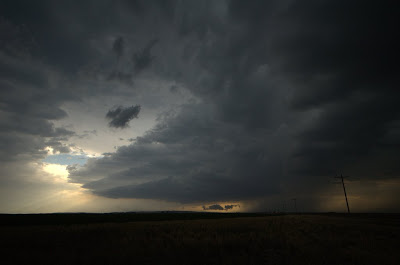
Finally on the south side of the storm. Check out the stacked-plate base. Insane.
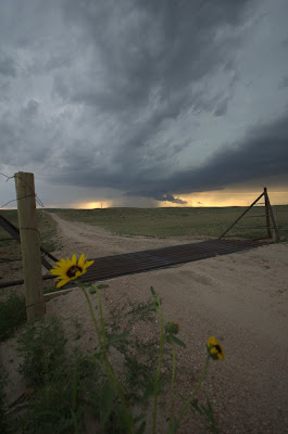
Getting a little artistic as the storm drops some suspicious lowerings.
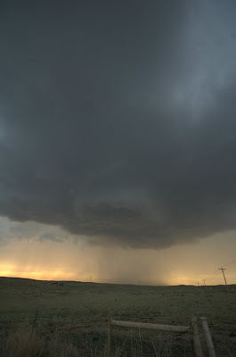
The storm is much closer now; check out that awesome lowering out of the base.

Shot of the day, right there. This was the last shot I took before the rain came and we had to pack up.
