May 24, 2011 – High risk, low yield
- Trip meter: about 500 miles
- Time: 11 hours
- From: Oklahoma City, OK To: Tulsa, OK
- Summary: Missed all the big storms in the tornado outbreak
D’oh.
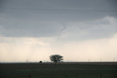
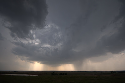
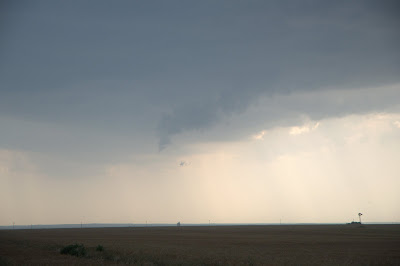
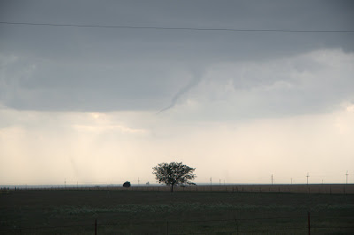
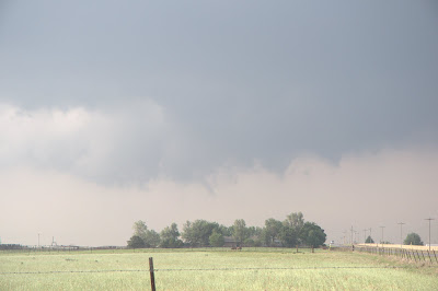
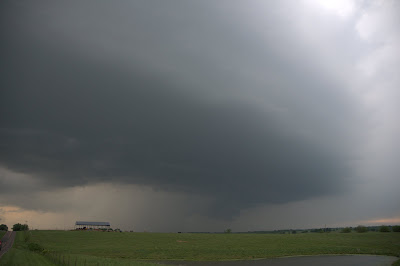
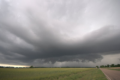
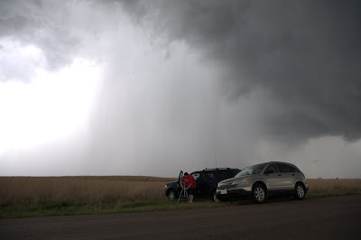
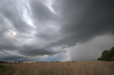
I sat in El Reno with Lou Rou until early afternoon until cells began to initiate around 2 PM, then we sped towards the dryline. The first cell that went up was a doozy, quickly becoming severe. It was tough to see with all the hills and trees, but we could make out a rapidly rotating wall cloud. However, it retreated to the northeast, and where we stopped there were no roads to follow it. As we were repositioning, it dropped a large tornado, just out of sight.
In trying to catch up with it again, I split off from Lou and attempted to get a better position, but he turned out to have made the right call, and saw the second and final tornado this cell produced. I got a whole lot of nothing.
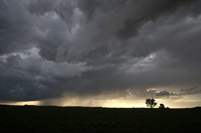
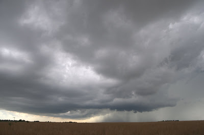
The rest of the day was spent driving through rain. For hours and hours, I tried to break through the massive line with embedded supercells, but system was moving so quickly that it was impossible. I never was able to get in a good position to see anything except a lot of heavy rain and wind.
I did not see any of the damage from the major tornadoes today, as I was further north, but I did drive through Geary, OK, where a tornado had passed west of downtown. Most of the damage was to trees, but I did see a few damaged houses as well, and power was out throughout the whole town. Drivers in town were very good at moving out of the way for emergency vehicles and treating dark stoplights as four-way stops.
The real fun began around 7:30. One cell had been able to form south of the line, and it was bearing down on the town of Beggs. I was north of it at the time, and thought I had enough time to cut in front of it. If I were 15 minutes earlier, I could have been in perfect position. As I came upon the mesocyclone from the north through the driving rain and hail, I had to stop and let it cross the road a few miles in front of me. It was far too dangerous to approach the area of circulation from this position; I could have literally driven into a tornado.
I later learned that this cell produced a tornado that caused damage in Haskell, and I thought I heard that one was reported in Beggs, as well. I definitely made the right call by turning around, and don’t regret missing that tornado one bit.
So yeah, that was my big outbreak day. No pictures, some shaky video footage, but in the end I arrived in Tulsa intact.
May 23, 2011 – Okeene tornado
- Photo gallery
- Trip meter: about 500 miles
- Time: 12 hours
- From: Springfield, MO To: Oklahoma City, OK
- Summary: Saw the full lifecycle of a supercell that dropped a brief tornado near Okeene, OK, and intercepted some other nice cells
Another day, another tornado. I could get used to this.
The severe parameters were insane for today. 5000 J/kg of CAPE in central OK, along with strong deep layer shear and surface dewpoints approaching 70 degrees. What more could you ask for?
At breakfest in Springfield, I talked to a trucker whose truck was totaled by the tornado yesterday. He was in his sleeper cab riding out the storm when it got flipped on its side. He showed me pictures of all the trailers laid over, and one was even laying on top of several others! He is lucky to be alive.
About an hour into my drive, I passed by Joplin, MO, which was devastated by the EF-4 yesterday. I did not pass through town, but I did observe quite a bit of damage from the interstate. Overturned semis, road signs and billboards completely gone, and many trees snapped completely in half. And I think the tornado only just skirted the interstate.
Beyond that, I continued southeast all the way to Enid, OK. Cells were firing along the dryline at this time, so I dropped south a little to get in better play for the triple point. A cell popped up near Fairview, and it was pretty close, so I decided to sit and watch it for a bit.
Well.
In about fifteen minutes, this little blip on radar transformed into a classic supercell thunderstorm. This storm was the only thing decent for miles, and it was not long before the chaser hordes converged on the severe-warned cell.
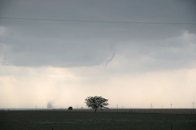
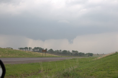
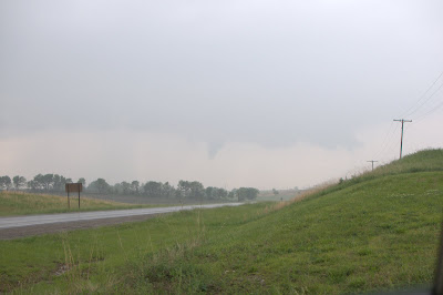
The cell was in its prime, and it had a brief “spin-up”. A rotating lowering dropped down from the high base and tried to form a funnel, but failed, and the lowering disappeared.
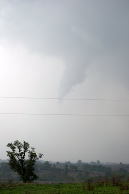
It was only a matter of time before the cell did the same thing again, and this time with a rousing success. A skinny, elongated funnel formed, with very visible circulation at the ground. The ground circulation trailed behind the funnel quite a bit, though storm motion was quite slow (about 25 MPH). I was in the perfect position the entire time, and it was a beautiful sight. It appeared to occur over open land, likely causing no damage.
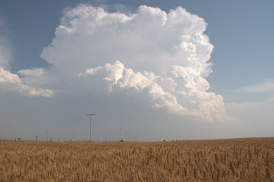
This storm was in its death throes, and slowly weakened, losing its tornado threat. When you’re in chase mode, you don’t get a break! There was another awesome-looking cell forming to the south, near Watonga, so I went after it. This cell was all by itself, and its updraft was very impressive.
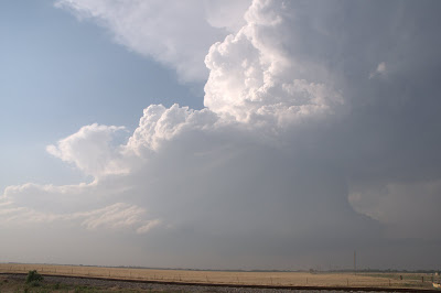
As I got into position, the storm’s crazy structure became apparent. There was a bell shape to the updraft base, and the whole storm was wrapping up and tilting over.
There was even a nice, low wall cloud.
The storm tried and it tried, but it just could not produce a tornado.
This cell went kaput, so I tried one more intercept on a high-precipitation beast up near Kingfisher. This storm was a massive hailer, with a 65+ dBZ core and an intense velocity couplet.
The storm motion was to the southeast, which was really confusing at first, because storms typically travel to the northeast. This threw me off several times today, and I was once again reminded of the fact as this monster shooed all the chasers south out of Kingfisher. The town was right underneath the rain-free meso as I was leaving, which was a little freaky, as there was major precipitation on three sides. 3-inch hail was reported with this cell. Ouch.
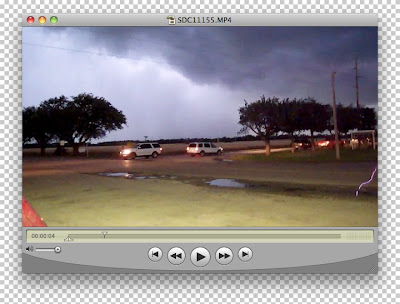
I got one more surprise when I was reviewing the day’s video footage. When I was filling up in Kingfisher, I was taking video as lightning struck nearby. I jumped in the air, freaking out that I was trying to pump gas. Now I knew this stroke was very close because I heard a crackle and a pop right before the flash of light. Only when I watched the video did I realize just how close it had come.
You can clearly see the lightning bolt in the left part of the frame, striking a puddle on the side of the road not twenty feet away. I’m almost certain that this isn’t an artifact of the camera, or some kind of reflection in the lens. Freaky, huh?
Today marks tornado #5 for me. The storms were fantastic, the people were nice, and the tornado was the icing on the cake. In all, not a bad day to spend on the plains.
Tomorrow has all the makings of a tornado outbreak. The SPC is already considering upgrading to high risk, which only happens a few days a year. They’re really serious this time. Tomorrow will be the last day of my chasecation, and it’s bound to be a memorable one.
May 22, 2011 – My first solo tornado!
- Photo gallery
- Trip meter: about 650 miles
- Time: 13 hours
- From: Joplin, MO To: Springfield, MO
- Summary: Caught a brief tornado that caused damage in Waverly, MO
Today must have been the most stressful, most rewarding, most exciting day of my chasing career. I finally made all the right calls and got lucky, bagging my first tornado on a solo chase.
I was not planning to chase today. I was going to drop Jess off at the Kansas City airport and start for home. All it took was one glance at the SPC outlook to change all that. We raced up to KCI, late as usual, and I left Jess at the airport around 1 PM. It was super unfortunate that she had to leave on this stellar storm day, and it was really tough to see her go.
I went north, just as cells in the area were beginning to initiate. Just like on Friday, they kept forming in one spot, right near Kansas City, and followed the same path to the northeast. The difference today was that these storms were popping up as supercells.
I spent much of the day driving in circles. The first cell I attempted to intercept was a cell that quickly put a tornado on the ground. Unfortunately, I was on the exact wrong side of the storm at that time, and was unable to see anything. It was only a matter of luck that I was able to squeeze into the area of the storm called the “notch”, which is a rain-free area to the southwest of the main updraft. It offers the best look at the wall cloud without any pesky precipitation getting in the way. Hill after hill yielded teasing peeks at the wall cloud, which was blocky and extremely low. The initial tornado reported with this cell must have lifted, but strong rotation was clearly evident, and I saw a brief funnel dip down as I was closing in.
Finally I found a good place to stop and observe the cell from the south as it moved ever so slowly to my north. The funnel was still evident, though it had lifted a bit.
Finally it dropped down and made a nice cone shape. Again, road options were not great, so I only had a few minutes to observe the tornado before it was obscured by rain. I saw dirt being kicked up on the ground, making this funnel officially a tornado on the ground.
I followed directly behind it, passing through the town of Waverly, which had been hit by the tornado. I observed a few downed trees, some of them in the road. One tree has also fallen on the roof of a house, though damage did not look extensive.
I followed behind the storm for a while, but the wall cloud was obscured by rain. Due to the poor road network, I was unable to get into position to see anything else from this cell. A nice juicy cell was next in line, however. The forward flank downdraft from the new cell was going to kill the current storm, so I abandoned it and headed for cell #2.
I got lucky and skirted the core of the second tornado-warned cell, which had a funnel cloud reported on it by I-70. By the time I got into position, however, it had weakened and was no longer a tornado threat.
I raced the final cell of the day to the northeast, on the northern end of the MCS that was beginning to develop. The cell was moving away and was just too far to catch it in time, and its tornado warning expired as soon as I reached it. I almost got stuck because the road was closed, but again got lucky and popped out the northern end of the MCS without incident.
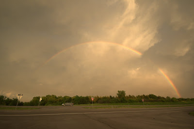
I waited for the mess of storms to pass out of the area, then went back south, headed towards Springfield, MO, where I am spending the night. I stopped several times to take in the post-storm goodies: mammatus clouds, some lightning, and even a full double rainbow stretching all the way across the sky.
It’s tough to get excited during the day because you have a lot of different things to focus on when chasing alone. After the fact, looking back on all the pictures and videos, it all seems very surreal. I’m very proud to have caught my first tornado on my own, though it is unfortunate that it caused damage. The tornado that tore apart Joplin today is also hugely unfortunate, and my heart goes out to the victims who will be struggling to pick up the pieces. I’m passing through Joplin on the way to Oklahoma City tomorrow, and I am not looking forward to surveying the damage. One SPC report says: “Over 20 semitrucks and cars flipped off I-44. All interstate signs gone and damage.” I sure hope the road is open…
Anyway, tomorrow looks like another big day. I’m headed to central/western Oklahoma for early afternoon. There is lots of instability, so things are going to happen early and quickly.
May 20, 2011 – Cold front shenanigans
- Photo gallery
- Trip meter: about 450 miles
- Time: 12 hours
- From: Salina, KS To: Wichita, KS
- Summary: Caught some severe thunderstorms in central KS on a “nothing” day
Today was a fun, relaxing day. Not much was forecast to happen in Kansas, and the higher probability of tornadoes was to be found in the Ark-La-Tex region, which is really far and completely not worth driving down for. We figured we’d play the weak dynamics up in Kansas and see what happens.
So, with low expectations for the day ahead, we moseyed out of Salina this morning full of IHOP french toast. We made it to our first target, Great Bend, a few hours later. The cold front had positioned itself directly to our west, near Dodge City. It was only 12:30 and towering cumulus were already beginning to form.
Some showers popped up north of I-70, so we went back north to Russell. By the time we got there, new stuff showed up on radar back to our south, so off we went, retracing our steps. This was annoying at first, but it turned out to be the right call.
We spent the rest of the day driving in circles and going back and forth on the highways around the towns of St. John and Pratt. That spot was golden, as storms initiated over Pratt and then slowly slid to the northeast along the cold front. Because they all moved in a line, we could essentially stay in one place and watch them pass by like a conveyor belt. They were slow and easy to follow and photograph. It made for a fun chase.
Nothing else was happening in Kansas at this time, and many chasers ended up converging on these storms. It wasn’t crowded at all, and people were acting safely.
Early in the day, we stopped alongside chasers Nathan Truninger and Aaron Barthol to observe our first storm. Our data access was very poor at this point, so we joined up with them so they could help us navigate. We ended up chasing with our new friends the rest of the day. Coordinating our chase over ham radio was a fun challenge, and it was good to have someone along to help make decisions. We had dinner with them in Wichita, and will possibly chase with them again tomorrow.
These storms were not particularly dangerous, and although they were severe-warned, these were marginal warnings at best. There was very weak rotation present, if any, in today’s cells.
In all, it was a surprisingly good day. We made all the right calls today, and it paid off. We were on the storms early, from initiation to dissipation. There was a little excitement (stray hail stones, and almost getting stuck on some slick roads), but today was mostly stress-free. It hardly felt like 450 miles of driving. Nathan and Aaron are great guys and were a pleasure to chase with.
May 19, 2011 – Mistakes were made
- Trip meter: 400+ miles
- Time: 13 hours
- From: Enid, OK To: Salina, KS
- Summary: Poor decision-making and lack of reliable data led to a day of missed opportunity
For a successful chase day, everything has to go right. In addition to sheer luck that atmospheric paramters will come together in the correct quantites and ratios to warrant severe weather, every decision must play out perfectly.
We camped out in Pratt, KS in the early afternoon, with the dryline off to our west. Storms began firing around 4 PM about an hour to our north, by I-70. With the NNE storm motion, we figured these cells were out of reach. In reality, if we had just gone for it and busted north, we probably could have arrived in time to see one of the cells drop a confirmed tornado. Instead we messed around with stuff that might have gone up near us, backtracking several times. Unfortunately, as ripe as the sky appeared overhead, these cells never became anything.
Moral of the day: if storms begin to form where they are supposed to form, don’t think twice about going for it, even if they seem out of reach. They probably aren’t.
By the time we finally made it north (with almost no data up to this point), the storm had retreated even further north, out of reach. When we passed both the TIV and Silver Lining Tours headed in the opposite direction, we knew that had missed the action. We called it a night and had dinner at Taco Bell in Salina, KS, reserving a room there.
After we ate, there was one more new storm that had formed on the flanking line of the big one, and it was easily within reach. We booked it north, just for fun, because we had nothing to lose. A funnel was reported with this storm near Minneapolis, KS, but we got there just too late to see it. Instead, we got to drive back and forth through the heavy precipitation core, promptly turning around as we entered marble-sized hail.
It was getting dark. One of our shorter road options back to Salina ended up turning to dirt. We were eager to turn in, so we decided to brave it. The road looked pretty solid. Major mistake. We crawled along for about two miles on this mess of a road, freshly-slick from the torrential rain an hour earlier. Things were going fairly well, if a little hairy, until we reached a part of the road that had not been traveled recently. The car instantly sunk an inch into the mud, and was sliding all over the place. With some careful maneuvering, we were able to about-face and retrace our steps back to pavement. Getting stuck out there was the absolute last thing we needed.
We made it back safe and sound, with not much to show for our trek today. Oh well. Two more days left.
May 17, 2011 – Colorado or bust
- Trip meter: 510 miles
- Time: 12 hours
- From: Norman, OK To: Woodward, OK
- Summary: Not much
The past couple days have not been kind to storm chasers. A cold front that swept across the plains last week scoured all the moisture from the air, leaving behind a dry, cool, stable air mass. This has limited any potential for severe weather.
We decided to make the best of the downtime. On Saturday, after picking up Jess at Kansas City, we drove to St. Louis, where we saw one of my favorite comedians, Brian Regain. His show was a riot, and well worth the trip. Sunday was spent at Six Flags St. Louis. Now this was a truly interesting day. The weather was drizzly all day, which meant that practically nobody was at the park… except us, and the other crazy people. The park was so empty, they even let us stay in our seats on the roller coasters, because nobody else was waiting in line to take our place. When all was said and done, we did 12 rides on 6 of the coasters. We would have done more, but a few of them were closed.
The models showed the potential for severe weather increasing as the week went on, so we decided to spend Monday travelling. 520 miles later, we ended up in Norman, OK. Some friends of mine from the NOAA Hollings program, Stephanie and Kristen, are graduate assistants at OU. It was great seeing them, catching up, and reminiscing about all our times in the summer of 2009.
Today, Tuesday, was a very marginal chase day. Moisture in the area was still extremely limited with dew points in the low-to-mid 40’s. The only real potential for severe weather was in the higher elevations of the high plains, which is an environment that can support storms with such low moisture.
Well, suffice to say, we did not make that play. We were banking on some dryline action in the OK/TX panhandle region. Alas, most of the day saw cirrus cloud cover that limited heating and created a pool of stable air. If any anemic storm had even initiated along the dryline, they would have quickly dissipated.
Today was a bust.
We drove from Norman, OK, all the way out to Guymon, OK. There were several other groups of chasers around, too, so we weren’t the only ones wishing for a miracle. We had dinner in Guymon and headed back east to Woodward, where we are spending the night in good position for tomorrow.
We weren’t counting on much happening today, but the lack of anything at all combined with a long drive made for a frustrating day. If it is any consolation, all the hotels in Woodward are booked full because of the number of chasers who were out here getting a tan with us. Cloud 9 tours is staying in our hotel, and we ran into College of DuPage at lunch. We also heard the California University of Pennsylvania is in town. Misery loves company!
May 12, 2011 – Missouri madness
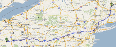
- Route map
- Photo gallery
- Trip meter: 730 miles
- Time: 14 hours
- From: Zanesville, OH To: Springfield, MO
- Summary: Caught a tornado-warned cell in southwestern MO on a marginal day
So the SPC put in a slight risk area down around the Ozarks. I woke up in eastern Ohio. “Challenge accepted”, I thought to myself as I rose out of bed at 6 AM. I finally hit the road at 7:30 and drove and drove and drove and drove.
Columbus? No problem! Indianapolis? Been there. St. Louis? Done it.
The setup looked questionable all day. The day started muggy, but dried out as the temperature rose into the upper 80’s. There was some ongoing convection from the night before, but it dried up as the sun rose higher. By 4 PM I had made it through St. Louis without incident, but the sky still resembled a calm spring day. I had no real target for the afternoon, since it was essentially a race to get as far as possible into the area of good air.
Four o’clock rolled around and the radar scope started lighting up with a dozen little cells. I could see them going up off the distance, amidst the haze. I continued trucking southwest on I-44.
Right before Lebanon, a road sign flashed: “ACCIDENT AHEAD. 45 MINUTE DELAY.” No way. This can’t be happening, not now. I pulled off and attempted to detour around the accident by venturing onto the local backroads, aiming for Springfield, MO, so I could rejoin the interstate there. It was soon that I realized the comedy of errors playing itself out:
MISTAKE #1: I had forgotten to fill up the gas tank. I barely had enough gas left to limp into Springfield.
MISTAKE #2: Those roads are windy. And tree-y. You can’t see anything back there.
MISTAKE #3: Good luck getting cell phone reception, much less a reliable data connection.
So there I was, chasing half-blind with some old radar data and windy, barely-paved roads. I caught myself laughing at the absurdity of it all.
Well, it turns out some of those backwoods towns are more substantial than I thought, and I was able to fill the gas tank. I glanced at the radar and saw a small cell about 20 miles to the west that had uncharacteristically split into two storms, with the right-hand taking a hard right-turn and strengthening. This “right-split” storm is commonly seen in highly-sheared environments, but not in a marginal day like today. This gave me a good feeling, and its motion was slow and in the right direction. Seeing no better options, I continued west, directly towards it.
Bam! Not two minutes later, the storm received a tornado warning! Elation. It might have been small, but it looked good on radar, and had a little bit of a weak velocity couplet, indicating a rotation mesocyclone. Things were looking up! Haze was obscuring the storm, so I hoped I could get there in time.
The structure made itself apparent as I meandered through some small towns and into more open country where I could see the dang thing. Overall, it had a nice look to it.
There was some wild motion underneath it. I was still rather far away, but I saw some dust or condensation rising into the base, originating from the ground. It was in a narrow spot, and I thought at first it could have been the start of a rotating funnel, but nothing else ever became of it. It was likely just some dirt being kicked up by a localized downburst.
I had gotten to the cell as it was dying. I let the storm pass directly to my north and felt the cool downdraft as it passed me by. I jogged in front of it once more, but there was no more cool structure to see, so I set my sights on Springfield.
Today, I accomplished 100% of what I had planned, and I was on one of only two tornado-warned cells in Missouri. After a 700 mile drive to get there, consdiering everything that might have gone wrong in between, I’d say this day was a complete success.
Did I get a little lucky? Of course. But when you’re chasing, sometimes that’s all you’ve got to rely on.
Some barbeque and a Boulevard later, I’m ready to dream of gumdrops and supercells. Good night!
May 11, 2011 – Oh, Zanesville, OH
- Trip meter: 680 miles
- Time: 13 hours
- From: Amherst, MA To: Zainesville, OH
Today was the perfect travel day: good weather, no traffic, and great mileage. I even surprised Jess by dropping by to see her at work. I spent a lot of time chatting it up with amateur radio operators across the country. I even got to work simplex (point-to-point, as opposed to through a repeater station), which is always a treat. It’s fun to talk with hams about storm chasing as a hobby. Of all the groups of people I talk to, they really seem to “get it” the most.
I had scheduled 500 miles for today, but having reached this milestone at 6 PM, I looked at the forecast and reconsidered my options. I drove another three hours and wound up in good old Zanesville, Ohio, a town whose name was eerily familiar. Only once I pulled into the hotel parking lot did I realize that I stayed in this exact Comfort Inn in 2009, also at the end of my first travel day.
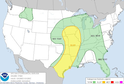
So, here is the new plan. If I leave around 7 AM tomorrow morning, this puts me in position for a possible chase day! The Storm Prediction Center has forecast a broad slight-risk area for tomorrow, stretching from southern Texas all the way into Iowa. This will be a cruddy setup to chase, and I’ll have to get up early, but I’m out here to chase, not to sleep! If I play my cards right and get a little lucky, tomorrow could be really special.
I’m targetting St. Louis for late afternoon. Hopefully I can get through there before rush hour. This gives me two major insterstate options: I-70 due west, and I-44 to the southwest. I think I-44 will bring me into better air, but it depends on what the storms in the area (currently-ongoing) do overnight.
No matter where I end up tomorrow night, it will make for an easy travel day to Kansas City on Friday so I can pick up Jess at the airport on Saturday morning.
Bring it on, May 12! Let’s see what you’ve got!
May 07, 2011 – Time for another chasecation
May is upon us! We’ve already seen a very active year, as April saw one of the largest tornado outbreaks in history. Since then, the troposphere has been quiet.
Too quiet.
Nerve-wrackingly quiet.
Regardless of the state of the lowest part of our atmosphere, I’ll be out there chasing it next week, sunny or stormy. Joining me for her first chasing experience will be my partner in crime, Jess. On Wednesday, I’m leaving Amherst, MA for Kansas City. Jess flies there on Saturday morning, and from there our weeklong trek begins.
After I complete my last exam on Monday morning, I will make final preparations for the chase. I will also make a ritual animal sacrifice or two, to appease the gods responsibile for tornados: Moisture, Instability, Lift, and Shear.
